
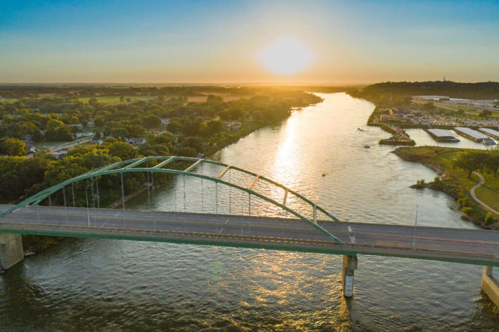
The 10 Longest Rivers in North America
Key Points
- There are many factors that make measuring rivers a difficult and somewhat subjective process. In this article, measurements reference the length of river stems rather than river systems.
- At 2,341 miles long, the Missouri River is the largest river in the United States, and runs through 7 states, eventually running into the Mississippi River, the nation’s second largest river.
- The Rio Grande River, the fourth largest in the US, forms the national border between the United States and Mexico in Texas.
- Four of the longest rivers in North America run through Canada: the Yukon River (emptying into the ocean in Alaska), Peace River, Saskatchewan River, and the Columbia River (crossing into the US).
The rivers of North America are the primary source of freshwater for the continent, making them essential natural resources. What do the rivers in North America look like? How large are these rivers? What types of wildlife live in and around them? Let’s take a look at the 10 longest rivers in North America. As we explore these rivers, we will be measuring their size based on length rather than depth or discharge amounts.
How Do You Measure Rivers?
Before we begin, first we need to provide a short note on measuring rivers. It’s not as exact as it sounds. For one, the distance of rivers changes as they carve new paths. Another complication is that rivers sometimes flow through lakes, so some sources will handle measuring through lakes differently.
Most importantly, the distance of rivers systems depends on which headwater – or tributary – you’re measuring from. For example, it’s still debated where the Nile begins and a new source for the Amazon River was just discovered in 2014.
For the sake of this article, we’re measuring just river stems rather than systems. For example, when measuring the headwaters of the Missouri River to the end of the Mississippi River, the entire river system is 3,902 miles. However, the Missouri River itself is 2,341 miles while the Mississippi measures 2,320 miles.
As you can see, measuring rivers is complicated! Many sources will list the Mackenzie River as the second-longest in North America at 2,635 miles. However, that’s a total system measurement, and for sake of this article, we’d measure its main river stem at 1,080 miles. That means that while different lists of the longest rivers will have varying lists, it doesn’t mean they’re wrong, but instead, they may simply be measuring different definitions of river length! With all that explanation out of the way, let’s get to the list!
10. Red River – 1,125 miles
Bob Pool/Shutterstock.com
| Red River | |
|---|---|
| Length | 1,125 miles |
| Ending Point | Atchafalaya River |
The Red River’s main stem is 1,125 miles long, spanning across the U.S. states of Texas, Oklahoma, Arkansas, and Louisiana. This river is named for the red color of its water. As it flows, it passes through “red beds” (red sedimentary rocks due to the presence of ferric oxides). This adds a reddish color to the water. The river eventually flows into the Atchafalaya River, creating a river system that spans 1,360 miles in total.
The Red River of the South is also unique because it is notably salty, even though this excess saltiness doesn’t come from the ocean. About 250 million years ago, an inland sea covered this area, leaving behind salt deposits. As the river flows across the region, the water becomes increasingly salty.
The Red River has a reputation for prize winning channel catfish, and also sports many other types of fish including smallmouth bass, fresh-water drum, sauger, carp, muskellunge, northern pike, bullheads, walleye, goldeye, mooneye, and lake sturgeon. You can also find migrating water birds along it’s shores.
9. Peace River – 1,195 miles
iStock.com/eppicphotography
| Peace River | |
|---|---|
| Length | 1,195 miles |
| Ending Point | Slave River |
The Peace River is the twelfth largest river in North America, stretching for 1,195 miles across Canada. It begins in the Rocky Mountains of northern British Columbia. The river flows through Alberta until it joins the Athabasca River. The two rivers combine to form the Slave River, which is a tributary of the Mackenzie River.
8. Saskatchewan River – 1,205 miles
Libor Fousek/Shutterstock.com
| Saskatchewan River | |
|---|---|
| Length | 1,205 miles |
| Ending Point | Lake Winnipeg |
The Saskatchewan River is the eleventh largest river in North America. It flows through Canada for 1,205 miles, running from the Rocky Mountains to Cedar Lake in central Manitoba. The Saskatchewan River is home to a wealth of wildlife, with over 200 species of birds, 48 species of fish, and an abundance of mammals.
Common birds found in this area include the ring-necked duck, mallard, canvasback, blue-winged teal, and Canadian goose. Fishes like northern pike, walleye, and the endangered lake sturgeon swim within the river’s current. Animals like elk, white-tailed deer, black bear, muskrat, beaver, mink, otter, lynx, and wolf run along the banks of the river and drink from its waters.
7. Columbia River – 1,243 miles
iStock.com/JPLDesigns
| Columbia River | |
|---|---|
| Length | 1,243 miles |
| Ending Point | Pacific Ocean |
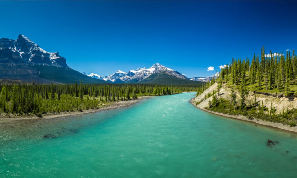
The Columbia River flows for 1,243 miles through the United States of America and Canada. It begins in the Rocky Mountains of British Columbia in Canada and flows northwest. The river then flows south into the U.S. state of Washington. The river turns west to form the border between Washington and Oregon and then empties into the Pacific Ocean. Along its journey, the river provides drinking water, irrigates farmland, and produces half the region’s electricity supply through hydroelectric dams.
The Columbia River provides homes and breeding grounds to many anadromous fish like coho, steelhead, sockeye, and Chinook salmon, as well as white sturgeon. The river once hosted the largest salmon runs on earth, with more than 30 million fish per year. However, engineering developments, dams, and nuclear power sites have polluted the river’s water and created barriers to many of these fish migrations.
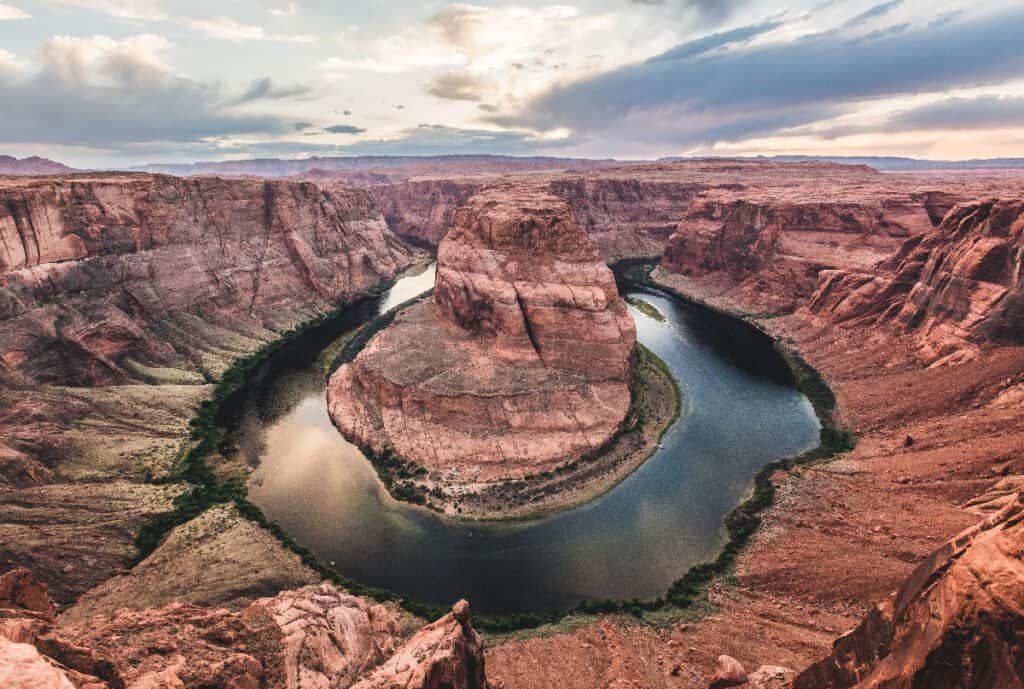
6. Colorado River – 1,450 miles
Markue/Shutterstock.com
| Colorado River | |
|---|---|
| Length | 1,450 miles |
| Ending Point | Gulf of California |
The Colorado River is the seventh longest river in North America. Beginning in the central Rocky Mountains in Colorado, the river’s watershed flows through seven U.S. states: Wyoming, Colorado, Utah, New Mexico, Nevada, Arizona, and California. The Colorado River also runs through the Grand Canyon and eleven different U.S. National Parks.
The Colorado River is home to 40 species of fish, many of which are unique to this river, like the razorback sucker, bonytail chub, Colorado pikeminnow, and the humpback chub. These fishes are currently at risk due to habitat loss, water diversion through dams, thermoelectric power stations, and evaporation.
5. Arkansas River – 1,460 miles

iStock.com/Michael Dean Shelton
| Arkansas River | |
|---|---|
| Length | 1,460 miles |
| Ending Point | Mississippi River |
The Arkansas River flows for 1,460 miles through the United States of America. The river starts in the Rocky Mountains near Leadville, Colorado. It flows through three U.S. states: Kansas, Oklahoma, and Arkansas. In Arkansas, it joins the Mississippi River. The course of the Arkansas River carved Arkansas Valley in Arkansas. The Arkansas Valley is 30-40 miles wide and separates the Ozark Mountains from the Ouachita Mountains. Some of the highest points in the state of Arkansas are found in this valley.
4. Rio Grande River – 1,896 miles
iStock.com/Greg Meland
| Rio Grande River | |
|---|---|
| Length | 1,896 miles |
| Ending Point | Gulf of Mexico |
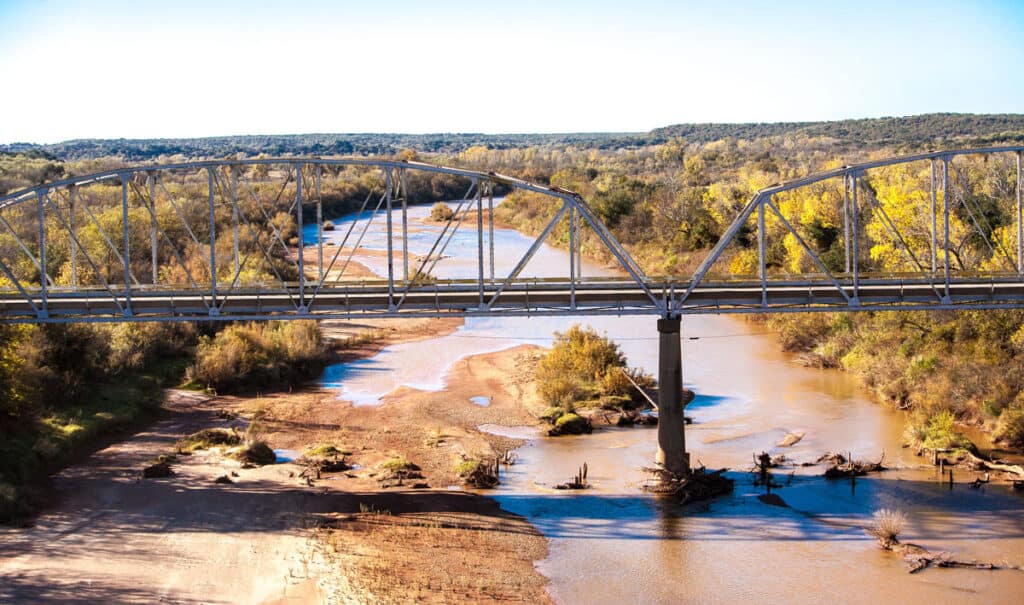
The Rio Grande is the fourth largest river in North America and the largest river in the U.S. state of Texas. The river begins in south-central Colorado then flows southeast through New Mexico and Texas until it empties into the Gulf of Mexico. The Rio Grande forms the national border between the United States and Mexico within Texas.
The Rio Grande supplies water to agricultural regions. In fact, only 20% of the river’s water makes it to the Gulf of Mexico. The Rio Grande is designated as an American Heritage River, and two portions of its length are preserved as a “National Wild and Scenic Rivers System.”
Find out about the width of the Rio Grande River.
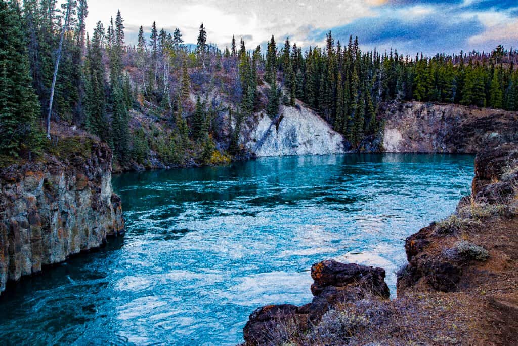
3. Yukon River – 1,980 miles
iStock.com/HeatherECampbell
| Yukon River | |
|---|---|
| Length | 1,980 miles |
| Ending Point | Bering Sea |
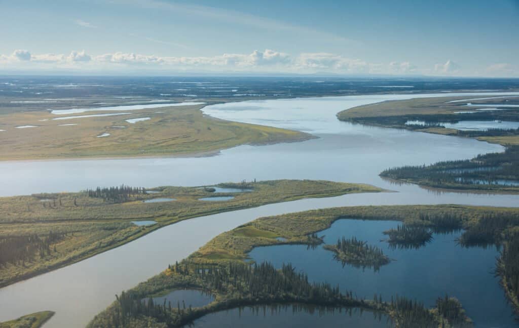
The Yukon River is the third largest river in North America. It is also the longest river in Yukon and Alaska. The river starts in British Columbia in Canada and flows through the Canadian territory of Yukon. It empties into the Bering Sea in the state of Alaska at the Yukon-Kuskokwim Delta. The upper basin of the Yukon River has alpine tundra, with sections of boreal forests. The river’s main stem is surrounded by forests of lodgepole pine, spruce, balsam, white birch, and trembling aspen trees.
The Yukon River is one of the most important rivers for salmon breeding. It has one of the longest salmon runs globally, hosting coho, chum, and Chinook salmon. Many other fish species live in the Yukon River as well, like pike, whitefish, Dolly Varden trout, Arctic grayling, burbots, cisco, and inconnu. Muskrats, moose, and beavers build homes along the Yukon River. Predators like Grizzly, brown, and black bears eat the fish living in the river. Birds like ptarmigan, ducks, grouse, swan, and geese make their home along the river’s edge.
2. Mississippi River – 2,320 miles
iStock.com/Willard
| Mississippi River | |
|---|---|
| Length | 2,320 miles |
| Ending Point | Gulf of Mexico |
The Mississippi is the second largest river in North America and is 2,320 miles long. However, the length of this river is often reported differently depending on the year or the measurement method used at the time. The Mississippi River flows through 10 U.S. states: Minnesota, Wisconsin, Iowa, Illinois, Missouri, Kentucky, Tennessee, Arkansas, Mississippi, and Louisiana. The Mississippi River was an essential part of the growth of the United States of America. Today it continues to be one of the world’s most important commercial waterways.
The Mississippi River provides a habitat for an abundance of wildlife. Here are just a few examples:
- At least 260 species of fish
- Several species of turtle (snapping, cooter, mud, musk, map, softshell, and painted turtles)
- At least 145 species of amphibians and reptiles, including the American alligator
- More than 50 mammal species
- 300 rare, threatened, or endangered species
The Mississippi River and Mississippi River basin also provides one of North America’s greatest migration routes for fish and birds. About 326 species of birds use the basin as a migratory flyway. 40% of waterfowls in the U.S. also use the river corridor during their spring and fall migrations.
1. Missouri River – 2,341 miles
iStock.com/Matthew Howieson
| Missouri River | |
|---|---|
| Length | 2,341 miles |
| Ending Point | Mississippi River |
The Missouri River is the largest in the United States and North America. This river flows through 7 states in the United States: Montana, North Dakota, South Dakota, Nebraska, Iowa, Kansas, and Missouri. It begins on the eastern slope of the Rocky Mountains near Three Forks, Montana. It flows for 2,341 miles until it joins the Mississippi River at St. Louis, Missouri. When the two rivers come together, they appear to be different colors. This is because the silt in the Missouri River makes it appear much lighter.
There are 300 species of bird and 150 species of fish in the Missouri River basin. Two of these fish species are native to the Missouri River, although rare: the paddlefish and the pallid sturgeon. The pallid sturgeon is an endangered species that can weigh around 85 pounds and live up to 100 years!
Summary of the 10 Largest Rivers in North America
Here’s a recap of the 10 largest rivers found in the United States and Canada:
| Rank | River | Length |
|---|---|---|
| 1 | Missouri River | 2,341 miles |
| 2 | Mississippi River | 2,320 miles |
| 3 | Yukon River | 1,980 miles |
| 4 | Rio Grande | 1,896 miles |
| 5 | Arkansas River | 1,460 miles |
| 6 | Colorado River | 1,450 miles |
| 7 | Columbia River | 1,243 miles |
| 8 | Saskatchewan River | 1,205 miles |
| 9 | Peace River | 1,195 miles |
| 10 | Red River | 1,125 miles |
Up Next…
Keep reading! We think you’ll like these other pages about snakes and other amazing animals.

More from A-Z Animals


Key Points
- There are many factors that make measuring rivers a difficult and somewhat subjective process. In this article, measurements reference the length of river stems rather than river systems.
- At 2,341 miles long, the Missouri River is the largest river in the United States, and runs through 7 states, eventually running into the Mississippi River, the nation’s second largest river.
- The Rio Grande River, the fourth largest in the US, forms the national border between the United States and Mexico in Texas.
- Four of the longest rivers in North America run through Canada: the Yukon River (emptying into the ocean in Alaska), Peace River, Saskatchewan River, and the Columbia River (crossing into the US).
The rivers of North America are the primary source of freshwater for the continent, making them essential natural resources. What do the rivers in North America look like? How large are these rivers? What types of wildlife live in and around them? Let’s take a look at the 10 longest rivers in North America. As we explore these rivers, we will be measuring their size based on length rather than depth or discharge amounts.
How Do You Measure Rivers?
Before we begin, first we need to provide a short note on measuring rivers. It’s not as exact as it sounds. For one, the distance of rivers changes as they carve new paths. Another complication is that rivers sometimes flow through lakes, so some sources will handle measuring through lakes differently.
Most importantly, the distance of rivers systems depends on which headwater – or tributary – you’re measuring from. For example, it’s still debated where the Nile begins and a new source for the Amazon River was just discovered in 2014.
For the sake of this article, we’re measuring just river stems rather than systems. For example, when measuring the headwaters of the Missouri River to the end of the Mississippi River, the entire river system is 3,902 miles. However, the Missouri River itself is 2,341 miles while the Mississippi measures 2,320 miles.
As you can see, measuring rivers is complicated! Many sources will list the Mackenzie River as the second-longest in North America at 2,635 miles. However, that’s a total system measurement, and for sake of this article, we’d measure its main river stem at 1,080 miles. That means that while different lists of the longest rivers will have varying lists, it doesn’t mean they’re wrong, but instead, they may simply be measuring different definitions of river length! With all that explanation out of the way, let’s get to the list!
10. Red River – 1,125 miles
Bob Pool/Shutterstock.com
| Red River | |
|---|---|
| Length | 1,125 miles |
| Ending Point | Atchafalaya River |
The Red River’s main stem is 1,125 miles long, spanning across the U.S. states of Texas, Oklahoma, Arkansas, and Louisiana. This river is named for the red color of its water. As it flows, it passes through “red beds” (red sedimentary rocks due to the presence of ferric oxides). This adds a reddish color to the water. The river eventually flows into the Atchafalaya River, creating a river system that spans 1,360 miles in total.
The Red River of the South is also unique because it is notably salty, even though this excess saltiness doesn’t come from the ocean. About 250 million years ago, an inland sea covered this area, leaving behind salt deposits. As the river flows across the region, the water becomes increasingly salty.
The Red River has a reputation for prize winning channel catfish, and also sports many other types of fish including smallmouth bass, fresh-water drum, sauger, carp, muskellunge, northern pike, bullheads, walleye, goldeye, mooneye, and lake sturgeon. You can also find migrating water birds along it’s shores.
9. Peace River – 1,195 miles
iStock.com/eppicphotography
| Peace River | |
|---|---|
| Length | 1,195 miles |
| Ending Point | Slave River |
The Peace River is the twelfth largest river in North America, stretching for 1,195 miles across Canada. It begins in the Rocky Mountains of northern British Columbia. The river flows through Alberta until it joins the Athabasca River. The two rivers combine to form the Slave River, which is a tributary of the Mackenzie River.
8. Saskatchewan River – 1,205 miles
Libor Fousek/Shutterstock.com
| Saskatchewan River | |
|---|---|
| Length | 1,205 miles |
| Ending Point | Lake Winnipeg |
The Saskatchewan River is the eleventh largest river in North America. It flows through Canada for 1,205 miles, running from the Rocky Mountains to Cedar Lake in central Manitoba. The Saskatchewan River is home to a wealth of wildlife, with over 200 species of birds, 48 species of fish, and an abundance of mammals.
Common birds found in this area include the ring-necked duck, mallard, canvasback, blue-winged teal, and Canadian goose. Fishes like northern pike, walleye, and the endangered lake sturgeon swim within the river’s current. Animals like elk, white-tailed deer, black bear, muskrat, beaver, mink, otter, lynx, and wolf run along the banks of the river and drink from its waters.
7. Columbia River – 1,243 miles
iStock.com/JPLDesigns
| Columbia River | |
|---|---|
| Length | 1,243 miles |
| Ending Point | Pacific Ocean |
The Columbia River flows for 1,243 miles through the United States of America and Canada. It begins in the Rocky Mountains of British Columbia in Canada and flows northwest. The river then flows south into the U.S. state of Washington. The river turns west to form the border between Washington and Oregon and then empties into the Pacific Ocean. Along its journey, the river provides drinking water, irrigates farmland, and produces half the region’s electricity supply through hydroelectric dams.
The Columbia River provides homes and breeding grounds to many anadromous fish like coho, steelhead, sockeye, and Chinook salmon, as well as white sturgeon. The river once hosted the largest salmon runs on earth, with more than 30 million fish per year. However, engineering developments, dams, and nuclear power sites have polluted the river’s water and created barriers to many of these fish migrations.
6. Colorado River – 1,450 miles
Markue/Shutterstock.com
| Colorado River | |
|---|---|
| Length | 1,450 miles |
| Ending Point | Gulf of California |
The Colorado River is the seventh longest river in North America. Beginning in the central Rocky Mountains in Colorado, the river’s watershed flows through seven U.S. states: Wyoming, Colorado, Utah, New Mexico, Nevada, Arizona, and California. The Colorado River also runs through the Grand Canyon and eleven different U.S. National Parks.
The Colorado River is home to 40 species of fish, many of which are unique to this river, like the razorback sucker, bonytail chub, Colorado pikeminnow, and the humpback chub. These fishes are currently at risk due to habitat loss, water diversion through dams, thermoelectric power stations, and evaporation.
5. Arkansas River – 1,460 miles
iStock.com/Michael Dean Shelton
| Arkansas River | |
|---|---|
| Length | 1,460 miles |
| Ending Point | Mississippi River |
The Arkansas River flows for 1,460 miles through the United States of America. The river starts in the Rocky Mountains near Leadville, Colorado. It flows through three U.S. states: Kansas, Oklahoma, and Arkansas. In Arkansas, it joins the Mississippi River. The course of the Arkansas River carved Arkansas Valley in Arkansas. The Arkansas Valley is 30-40 miles wide and separates the Ozark Mountains from the Ouachita Mountains. Some of the highest points in the state of Arkansas are found in this valley.
4. Rio Grande River – 1,896 miles
iStock.com/Greg Meland
| Rio Grande River | |
|---|---|
| Length | 1,896 miles |
| Ending Point | Gulf of Mexico |
The Rio Grande is the fourth largest river in North America and the largest river in the U.S. state of Texas. The river begins in south-central Colorado then flows southeast through New Mexico and Texas until it empties into the Gulf of Mexico. The Rio Grande forms the national border between the United States and Mexico within Texas.
The Rio Grande supplies water to agricultural regions. In fact, only 20% of the river’s water makes it to the Gulf of Mexico. The Rio Grande is designated as an American Heritage River, and two portions of its length are preserved as a “National Wild and Scenic Rivers System.”
Find out about the width of the Rio Grande River.
3. Yukon River – 1,980 miles
iStock.com/HeatherECampbell
| Yukon River | |
|---|---|
| Length | 1,980 miles |
| Ending Point | Bering Sea |
The Yukon River is the third largest river in North America. It is also the longest river in Yukon and Alaska. The river starts in British Columbia in Canada and flows through the Canadian territory of Yukon. It empties into the Bering Sea in the state of Alaska at the Yukon-Kuskokwim Delta. The upper basin of the Yukon River has alpine tundra, with sections of boreal forests. The river’s main stem is surrounded by forests of lodgepole pine, spruce, balsam, white birch, and trembling aspen trees.
The Yukon River is one of the most important rivers for salmon breeding. It has one of the longest salmon runs globally, hosting coho, chum, and Chinook salmon. Many other fish species live in the Yukon River as well, like pike, whitefish, Dolly Varden trout, Arctic grayling, burbots, cisco, and inconnu. Muskrats, moose, and beavers build homes along the Yukon River. Predators like Grizzly, brown, and black bears eat the fish living in the river. Birds like ptarmigan, ducks, grouse, swan, and geese make their home along the river’s edge.
2. Mississippi River – 2,320 miles
iStock.com/Willard
| Mississippi River | |
|---|---|
| Length | 2,320 miles |
| Ending Point | Gulf of Mexico |
The Mississippi is the second largest river in North America and is 2,320 miles long. However, the length of this river is often reported differently depending on the year or the measurement method used at the time. The Mississippi River flows through 10 U.S. states: Minnesota, Wisconsin, Iowa, Illinois, Missouri, Kentucky, Tennessee, Arkansas, Mississippi, and Louisiana. The Mississippi River was an essential part of the growth of the United States of America. Today it continues to be one of the world’s most important commercial waterways.
The Mississippi River provides a habitat for an abundance of wildlife. Here are just a few examples:
- At least 260 species of fish
- Several species of turtle (snapping, cooter, mud, musk, map, softshell, and painted turtles)
- At least 145 species of amphibians and reptiles, including the American alligator
- More than 50 mammal species
- 300 rare, threatened, or endangered species
The Mississippi River and Mississippi River basin also provides one of North America’s greatest migration routes for fish and birds. About 326 species of birds use the basin as a migratory flyway. 40% of waterfowls in the U.S. also use the river corridor during their spring and fall migrations.
1. Missouri River – 2,341 miles
iStock.com/Matthew Howieson
| Missouri River | |
|---|---|
| Length | 2,341 miles |
| Ending Point | Mississippi River |
The Missouri River is the largest in the United States and North America. This river flows through 7 states in the United States: Montana, North Dakota, South Dakota, Nebraska, Iowa, Kansas, and Missouri. It begins on the eastern slope of the Rocky Mountains near Three Forks, Montana. It flows for 2,341 miles until it joins the Mississippi River at St. Louis, Missouri. When the two rivers come together, they appear to be different colors. This is because the silt in the Missouri River makes it appear much lighter.
There are 300 species of bird and 150 species of fish in the Missouri River basin. Two of these fish species are native to the Missouri River, although rare: the paddlefish and the pallid sturgeon. The pallid sturgeon is an endangered species that can weigh around 85 pounds and live up to 100 years!
Summary of the 10 Largest Rivers in North America
Here’s a recap of the 10 largest rivers found in the United States and Canada:
| Rank | River | Length |
|---|---|---|
| 1 | Missouri River | 2,341 miles |
| 2 | Mississippi River | 2,320 miles |
| 3 | Yukon River | 1,980 miles |
| 4 | Rio Grande | 1,896 miles |
| 5 | Arkansas River | 1,460 miles |
| 6 | Colorado River | 1,450 miles |
| 7 | Columbia River | 1,243 miles |
| 8 | Saskatchewan River | 1,205 miles |
| 9 | Peace River | 1,195 miles |
| 10 | Red River | 1,125 miles |
Up Next…
Keep reading! We think you’ll like these other pages about snakes and other amazing animals.