
Discover the “Lost” 6th Great Lake That Was Bigger Than All Others Combined!
Believe it or not, but there was once a Great Lake that was four times larger than Lake Superior. Perhaps even more interesting, this lake only disappeared mere thousands of years ago. Let’s dive into the history of Lake Agassiz and discover how its remnants can still be found across much of the United States and Canada today!
The Background on the “Lost: Great Lake: Lake Agassiz
The Great Lakes of North America are: Huron, Ontario, Michigan, Erie, and Superior. These lakes make up the border between a few states and the neighboring country of Canada. But once upon a time, there was a lake bigger than all of the other great likes combined: Lake Agassiz.
Lake Superior is the largest Great Lake by far, clocking in at 31,699 miles in its expanse. Lakes Michigan and Huron bleed together and could be considered one lake, and are 45,300 square miles when grouped. The Great Lakes are the largest body of freshwater globally, making up a whopping 21% of the world’s water resources.
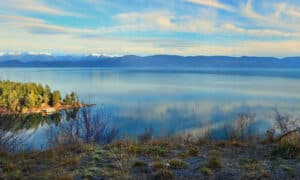
Lake Agassiz is no longer around, but while it existed, it was the largest known glacial lake, more than four times the size of Lake Superior. Lake Agassiz was estimated to be around 115,831 square miles.
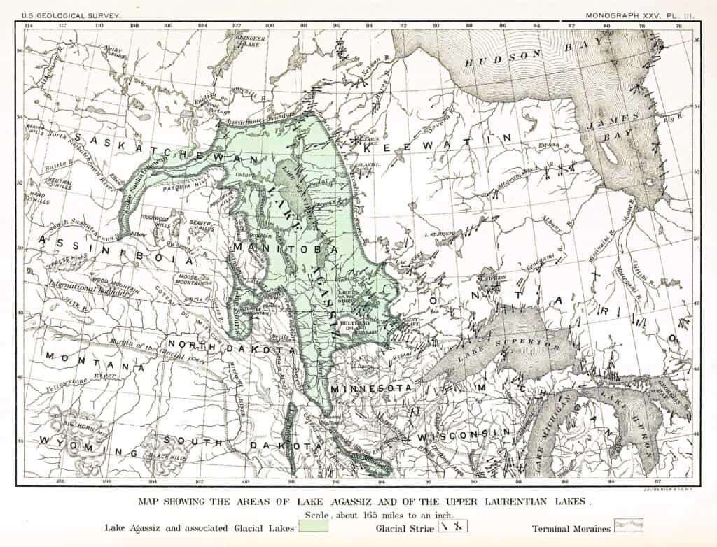
Public Domain
Today, the remnants of Lake Agassiz have been discovered throughout lakes across Minnesota, Manitoba, and the entire region. Lakes that are now in the place where lake Agassiz once reigned include:
- Lake Winnipeg
- Lake Manitoba
- Lake Winnipegosis
- Rainy Lake
- Lake of the Woods
- Red Lake
These lakes make up the last remnants of North America’s once-greatest lake. Now that we know where Lake Agassiz is located and how big it is, let’s delve into the essential questions.
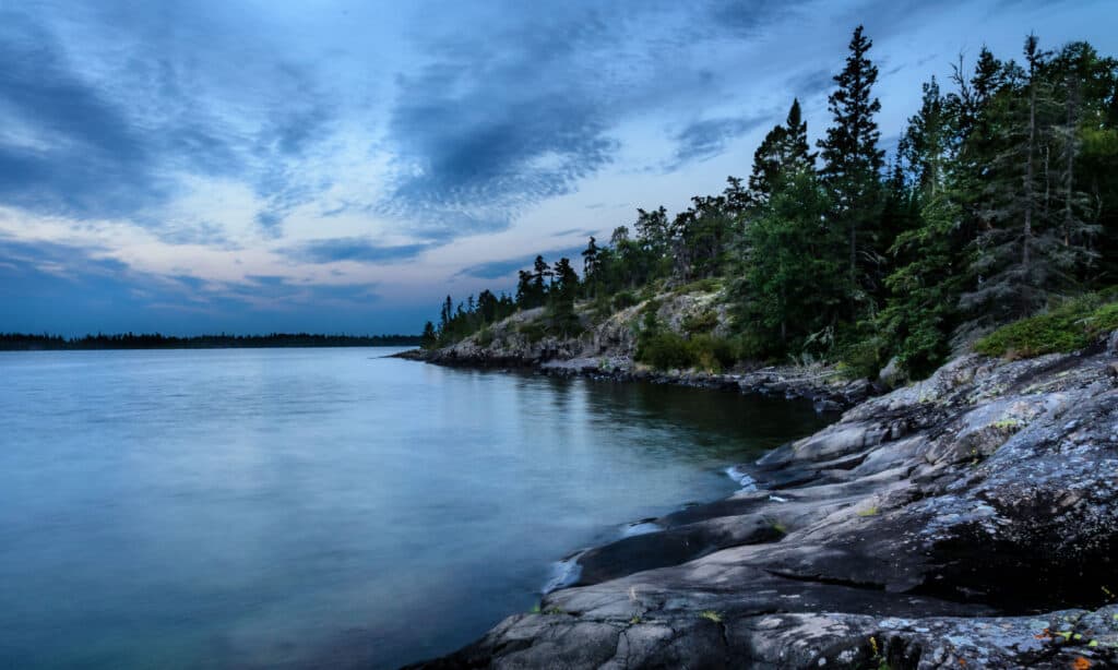
Why is Lake Agassiz Important?
iStock.com/Posnov
As stated above, Lake Agassiz made its name as the largest glacial lake on the continent. It reached outward from Manitoba and stretched as far as Minnesota and North Dakota.
The lake was finally named in 1879. Naturalist and geologist Louis Agassiz was whom it was named after, as he was well-known for his studies about glaciers. Since the lake was formed due to a glacier, it was relevant to his studies.
The lake was vital because it collected the runoff of local rivers, and eventually, its floodwaters helped form the Great Lakes themselves, or at least significantly impacted Lake Superior.
The death of Lake Agassiz, more so than its life, is what draws its importance. It assisted in global shifts like climate change and sea levels.
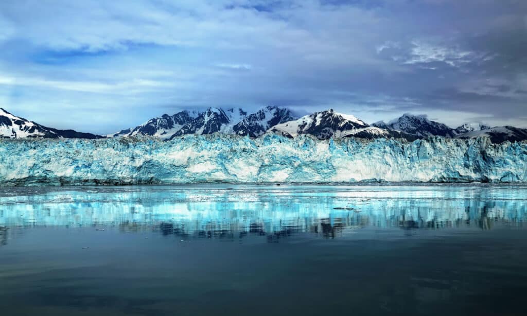
How Did Lake Agassiz Form?
iStock.com/Spaceliner
Much of North America was concealed in a vast ice sheet for long periods of recent history. The ice sheet was called the Laurentide Ice Sheet.
However, as the climate of the earth began to warm, this ice sheet began disintegrating. As massive glaciers melt, their water is often trapped – or dammed – by ice. As glaciers moved north and south across various periods of cooling and warming in the past 30,000 years, Lake Agassiz formed.
Its exact boundaries continued changing, with the lake at times even growing beyond the 115,831 square mile surface area described above. Let’s look at some of the periods this massive lake experienced before it eventually disappeared.
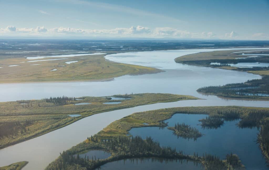
How did Lake Agassiz Drain or Disappear?
iStock.com/eppicphotography
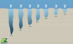
The Laurentide Ice Sheet didn’t disappear all at once. It shifted multiple times, receding and emerging. This led to five separate stages of the lake.
- Lockhart Phase– Water collected in the Red River Valley before eventually overflowing into the Minnesota and Mississippi Rivers. This was the early years of Lake Agassiz, and it was 738 feet deep.
- Moorhead Phase– The ice sheet began to melt from the North, which caused Lake Agassiz’s waters to flow southward toward what would today be Lake Superior. From there, it flowed out the Mississippi River and to the Gulf of Mexico. The average depth was 846 feet deep.
- Emerson Phase– This phase had constant fluctuations, and there might not have been an outlet during this time for the lake. This means that for a short while, it was a “terminal lake,” or a lake with no outflows or exits for which water can go.
- Nipigon Phase– Many low-level outlets were created in this phase for the waters of Lake Agassiz to flow. These flows filled Lake Michigan and Lake Huron.
- Ojibway Phase– At this point, Lake Agassiz joined with Lake Ojibway and became its largest size yet. The drainage caused by this lake combination raised sea levels, and its effects can still be seen today.
Around 10,000 years ago, Lake Agassiz completely drained out of North Dakota. The Laurentide Ice Sheet moved some time again, causing the lake to drain into Lake Superior and ultimately flood the Red River Valley and the Minnesota River.
The bottom line – Lake Agassiz’s draining not only shaped huge amounts of the modern Great Lakes but also rose global sea levels by anywhere from about 1 to 3 meters (3 to 9 feet). The draining of Lake Agassiz was a truly historic even that shaped much of not only America’s, but the world’s geography today!
What Fish Lived in Lake Agassiz?

FedBul/Shutterstock.com
As one of the largest lakes in existence, Lake Agassiz was around to provide water to all manner of creatures. From the giant ground sloth to the woolly mammoth, all came to sate their thirst thanks to the lake.
There was also plenty of fish to go around, as the lake was rich in its own life. These fish included:
- Goldeye
- Lake Sturgeon
- Lake Trout
- Northern Pike
- Walleye
The silt formed at the bottom of the glacial lake was rich in nutrients, and when the lake eventually flooded the Red River Valley, that silt was deposited there and can still be found today.
Over 700 miles across and 200 miles wide, Lake Agassiz was an essential resource for its time. Through thousands of years, the lake changed in size and depth, outlets forming and closing at the ice sheet shifted until, eventually, the lake drained away completely.
It is critical to our understanding of ourselves and our planet to know these facts. Lake Agassiz helped transform the climate at the end of an ice age, filling much of the lakes that we know today.

More from A-Z Animals


Believe it or not, but there was once a Great Lake that was four times larger than Lake Superior. Perhaps even more interesting, this lake only disappeared mere thousands of years ago. Let’s dive into the history of Lake Agassiz and discover how its remnants can still be found across much of the United States and Canada today!
The Background on the “Lost: Great Lake: Lake Agassiz
The Great Lakes of North America are: Huron, Ontario, Michigan, Erie, and Superior. These lakes make up the border between a few states and the neighboring country of Canada. But once upon a time, there was a lake bigger than all of the other great likes combined: Lake Agassiz.
Lake Superior is the largest Great Lake by far, clocking in at 31,699 miles in its expanse. Lakes Michigan and Huron bleed together and could be considered one lake, and are 45,300 square miles when grouped. The Great Lakes are the largest body of freshwater globally, making up a whopping 21% of the world’s water resources.
Lake Agassiz is no longer around, but while it existed, it was the largest known glacial lake, more than four times the size of Lake Superior. Lake Agassiz was estimated to be around 115,831 square miles.
Public Domain
Today, the remnants of Lake Agassiz have been discovered throughout lakes across Minnesota, Manitoba, and the entire region. Lakes that are now in the place where lake Agassiz once reigned include:
- Lake Winnipeg
- Lake Manitoba
- Lake Winnipegosis
- Rainy Lake
- Lake of the Woods
- Red Lake
These lakes make up the last remnants of North America’s once-greatest lake. Now that we know where Lake Agassiz is located and how big it is, let’s delve into the essential questions.
Why is Lake Agassiz Important?
iStock.com/Posnov
As stated above, Lake Agassiz made its name as the largest glacial lake on the continent. It reached outward from Manitoba and stretched as far as Minnesota and North Dakota.
The lake was finally named in 1879. Naturalist and geologist Louis Agassiz was whom it was named after, as he was well-known for his studies about glaciers. Since the lake was formed due to a glacier, it was relevant to his studies.
The lake was vital because it collected the runoff of local rivers, and eventually, its floodwaters helped form the Great Lakes themselves, or at least significantly impacted Lake Superior.
The death of Lake Agassiz, more so than its life, is what draws its importance. It assisted in global shifts like climate change and sea levels.
How Did Lake Agassiz Form?
iStock.com/Spaceliner
Much of North America was concealed in a vast ice sheet for long periods of recent history. The ice sheet was called the Laurentide Ice Sheet.
However, as the climate of the earth began to warm, this ice sheet began disintegrating. As massive glaciers melt, their water is often trapped – or dammed – by ice. As glaciers moved north and south across various periods of cooling and warming in the past 30,000 years, Lake Agassiz formed.
Its exact boundaries continued changing, with the lake at times even growing beyond the 115,831 square mile surface area described above. Let’s look at some of the periods this massive lake experienced before it eventually disappeared.
How did Lake Agassiz Drain or Disappear?
iStock.com/eppicphotography
The Laurentide Ice Sheet didn’t disappear all at once. It shifted multiple times, receding and emerging. This led to five separate stages of the lake.
- Lockhart Phase– Water collected in the Red River Valley before eventually overflowing into the Minnesota and Mississippi Rivers. This was the early years of Lake Agassiz, and it was 738 feet deep.
- Moorhead Phase– The ice sheet began to melt from the North, which caused Lake Agassiz’s waters to flow southward toward what would today be Lake Superior. From there, it flowed out the Mississippi River and to the Gulf of Mexico. The average depth was 846 feet deep.
- Emerson Phase– This phase had constant fluctuations, and there might not have been an outlet during this time for the lake. This means that for a short while, it was a “terminal lake,” or a lake with no outflows or exits for which water can go.
- Nipigon Phase– Many low-level outlets were created in this phase for the waters of Lake Agassiz to flow. These flows filled Lake Michigan and Lake Huron.
- Ojibway Phase– At this point, Lake Agassiz joined with Lake Ojibway and became its largest size yet. The drainage caused by this lake combination raised sea levels, and its effects can still be seen today.
Around 10,000 years ago, Lake Agassiz completely drained out of North Dakota. The Laurentide Ice Sheet moved some time again, causing the lake to drain into Lake Superior and ultimately flood the Red River Valley and the Minnesota River.
The bottom line – Lake Agassiz’s draining not only shaped huge amounts of the modern Great Lakes but also rose global sea levels by anywhere from about 1 to 3 meters (3 to 9 feet). The draining of Lake Agassiz was a truly historic even that shaped much of not only America’s, but the world’s geography today!
What Fish Lived in Lake Agassiz?
FedBul/Shutterstock.com
As one of the largest lakes in existence, Lake Agassiz was around to provide water to all manner of creatures. From the giant ground sloth to the woolly mammoth, all came to sate their thirst thanks to the lake.
There was also plenty of fish to go around, as the lake was rich in its own life. These fish included:
- Goldeye
- Lake Sturgeon
- Lake Trout
- Northern Pike
- Walleye
The silt formed at the bottom of the glacial lake was rich in nutrients, and when the lake eventually flooded the Red River Valley, that silt was deposited there and can still be found today.
Over 700 miles across and 200 miles wide, Lake Agassiz was an essential resource for its time. Through thousands of years, the lake changed in size and depth, outlets forming and closing at the ice sheet shifted until, eventually, the lake drained away completely.
It is critical to our understanding of ourselves and our planet to know these facts. Lake Agassiz helped transform the climate at the end of an ice age, filling much of the lakes that we know today.